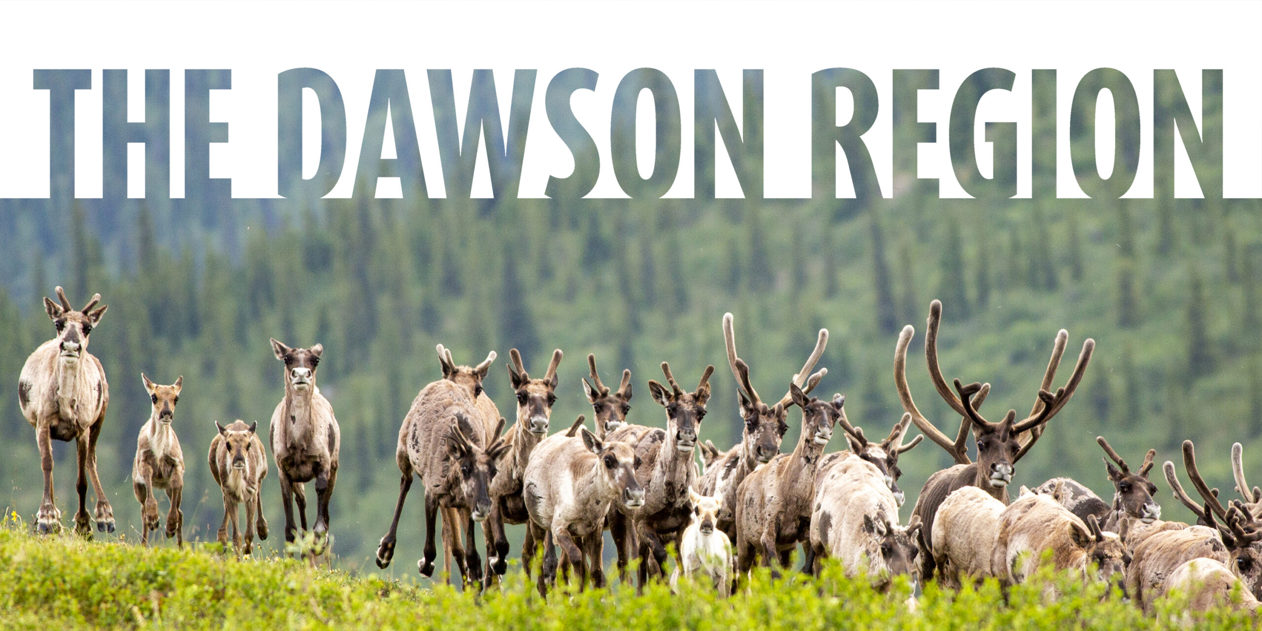
Fortymile caribou herd by Malkolm Boothroyd
The Dawson Region is steeped in the history and culture of the Tr’ondëk Hwëch’in people. Land use planning is underway and will shape the region’s future.
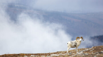
For many people, Dawson is synonymous with mining and the Klondike Gold Rush, but the region holds so much more. Dall sheep and wolverines live among the rugged peaks of the Tombstones and Ogilvies, and tens of thousands of Fortymile caribou spill through the hills of the Dawson Range. Birds migrate from across the hemisphere to nest in the wetlands along Scottie Creek and the Indian River, and salmon swim upriver for thousands of kilometres to spawn in gravelled creeks.
Mining has transformed parts of the Dawson Region, from the Klondike Gold Rush up to today. Still, the region hosts vast landscapes of intact boreal forest, wetlands that store ancient peat and carbon, and soaring mountains etched with hoofprints. These landscapes anchor cultural teachings and outdoor pursuits like hiking, paddling, berry picking, hunting and fishing.
Where We Stand Now – the Dawson Region Recommended Plan
An independent six-person Commission, with members nominated by Tr’ondëk Hwëch’in and the Yukon Government, is preparing the Dawson Region Plan. They released a Recommended Plan in September 2022, which builds on the draft plan released in 2021.
The planning process flows from Tr’ondëk Hwëch’in’s Final Agreement, a treaty that allows everyone to share their vision for the region and shape its future. With this opportunity comes an obligation to uphold the Final Agreement, which speaks about needing to “protect a way of life that is based on an economic and spiritual relationship between Tr’ondëk Hwëch’in and the land.”
Meeting these ambitions — and living up to our treaty obligations — requires not only holding steadfast to the strengths of the Recommended Plan, but building upon them.
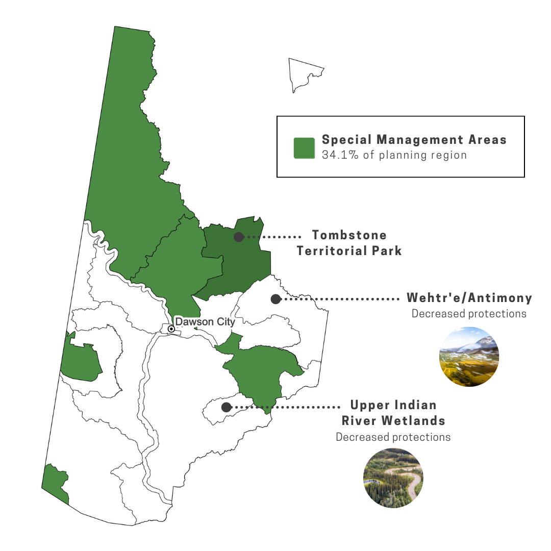
Big strides forward but there’s work left to do
When the Draft Plan was released, many people took the time to call for stronger protections across the Dawson Region. The Planning Commission acted on much of what was said. Where the draft plan left the Fortymile caribou herd vulnerable to impacts from roads and hardrock exploration, the Recommended Plan now includes a new policy to prevent hardrock mining activities in the herd’s key summer habitats.
The Recommended Plan also did away with the weak two tier conservation system, where only some conservation areas had full protection. Now all of the conservation areas in the Recommended Plan have enduring protections, with frameworks in place for Tr’ondëk Hwëch’in to co-manage their traditional lands. Yet, for all its improvements the Recommended Plan still has flaws. With your help, we’re calling on the Planning Commission to strengthen some key aspects of the plan.
Securing a healthy future for the Dawson Region
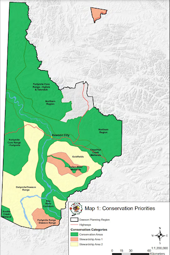
Tr’ondëk Hwëch’in have laid out a comprehensive vision of conservation in the Dawson Region, backed by a deep collective knowledge and understanding of the land. These priorities, presented to the Planning Commission in late 2020 and outlined on the map below, weave together the value of water and waterways, habitat for fish and wildlife, the importance of intact and connected ecosystems, and cultural landscapes rich in stories, songs, traditional place names and long used trails.
CPAWS Yukon echoes these priorities and we hope they will be fully reflected in the final plan.
Tr’ondëk Hwëch’in’s conservation priorities map and report, “Ninänkäk hǫzǫ wëk’ä̀tr’ë̀nòhcha (We Take Good Care of Our Land)” can be found here.
Safeguards for the Fortymile caribou herd
The Fortymile caribou herd once numbered around a quarter million animals and ranged throughout the central Yukon and Alaska, some winters migrating almost as far south as Whitehorse. Today the herd is still recovering from a population crash in 1970’s that left less than 6000 caribou remaining. While a concerted effort has allowed the herd’s population to steadily grow, the herd has not reoccupied its former range or reached its historic population peaks.
The herd’s Yukon range is contracted to its very core, in the hills between Dawson City and Fairbanks. Over a quarter of this core range is blanketed by quartz mining claims. While the Recommended Plan boosted protections for the Fortymile caribou herd, a key part of their core habitat remains open to hardrock mining and high levels of disturbances. Study after study[1],[2],[3]— from Alaska and the Yukon, to Alberta and the Northwest Territories — warn of the negative impacts to caribou from industrial development. The impacts of climate change and industrial development have left a lasting impact on the Fortymile caribou herd’s former range, and the herd may never reoccupy these lands. That makes it even more critical to safeguard the herd’s present range in the mountains in the west of the Dawson Region.
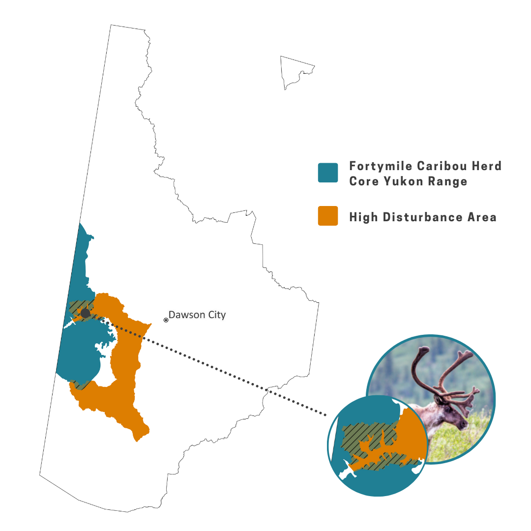
Our recommendation: Prioritize protecting the Fortymile caribou herd’s key habitat over accessing minerals.
Stem wetland loss
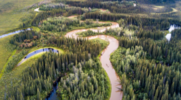
From Scottie Creek to the Indian River to the Tintina Trench, the Dawson Region is home to bountiful wetlands. These ecosystems brim with life, store tremendous amounts of carbon, and were important First Nation harvesting grounds long before gold was ever mined from them.
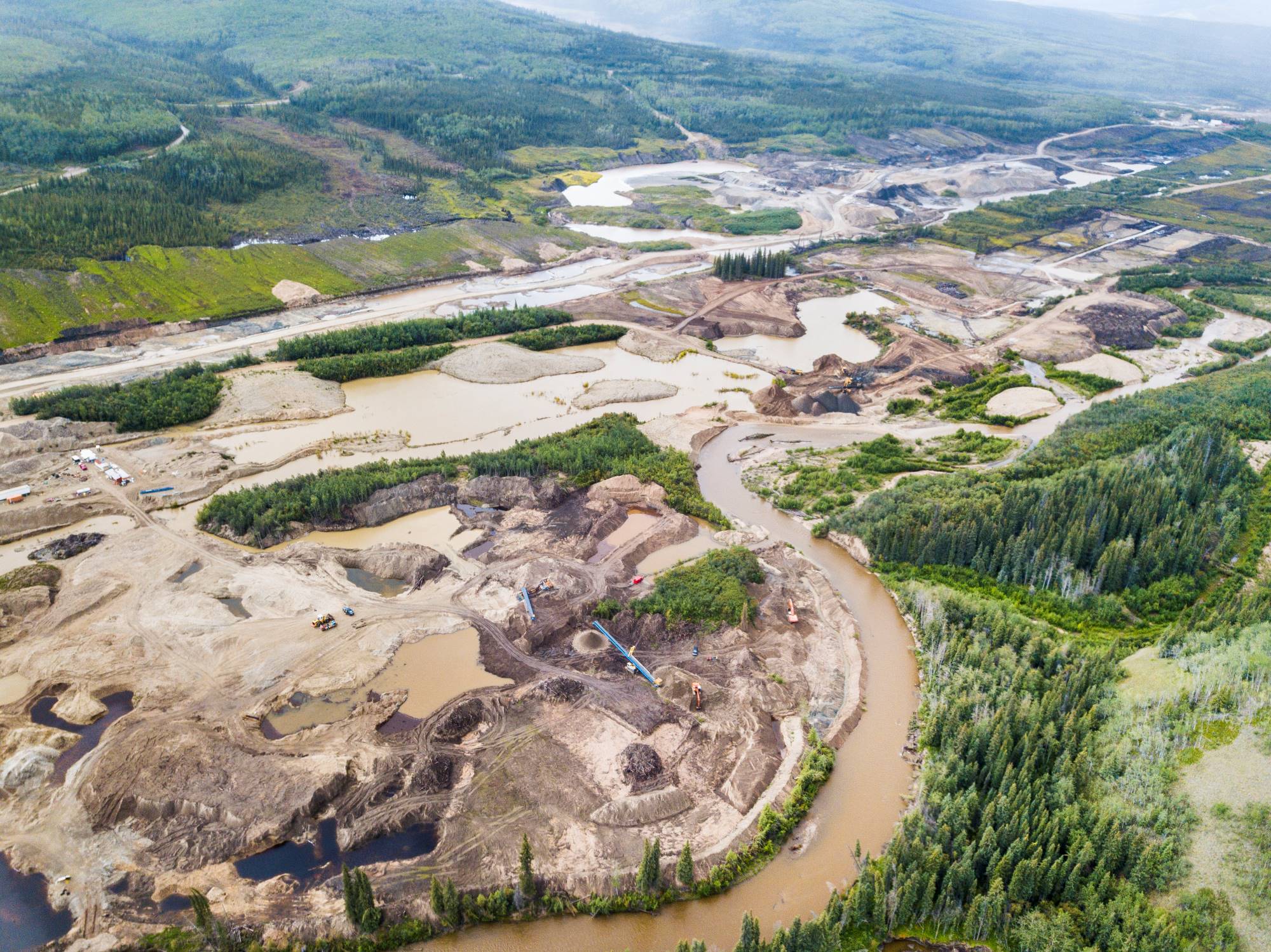
Wetlands, especially in the Indian River, are being lost at an alarming rate as the footprint of placer mining steadily expands through the Dawson Region’s valleys. When wetlands are disturbed, habitats are lost and carbon is lost to the atmosphere. CPAWS Yukon estimates that carbon losses from developing fens and swamps in the Indian River alone could release as much carbon as 125,000 cars do in a year, or running Whitehorse’s LNG plant around the clock for a decade. The Recommended Plan has provided protections to wetlands in the Tintina Trench and Scottie Creek area, but in the much of Indian River, where wetlands are most in danger, there are few protections. The Final Dawson Plan should take bold action to protect wetlands in the Indian River, like adding special protections for fens, and lowering thresholds for allowable disturbance around wetlands and rivers.
Our recommendation: While many of the Indian River’s wetlands have been lost forever, it’s not too late to protect those that remain, including the entirety of the upper watershed, Nän Dhòhdäl.
Protect ecologically and culturally rich landscapes
While the Recommended Plan made many strides forwards from the Draft Plan, it took a backwards step for the Wehtr’e (Antimony) landscape at the flanks of Tombstone Territorial Park, in the culturally rich Dempster area. A haven for traditional activities and an important home to mountain caribou and Dall sheep, this landscape was identified as a conservation area in the draft but is open for development in the plan’s latest iteration. A reluctance to prioritize habitat over hardrock mining claims is likely to blame but we are hopeful that decision makers will restore protections for this critical landscape.
The Tädzan Dëk (White River) landscape is home to the Klondike Plateau ecoregion, an ancient Beringian landscape that escaped glaciation and hosts unique ecosystems as a result. Protecting a meaningful portion of each of Yukon’s ecoregions is a goal of the territory’s parks legislation and a way to preserve the diversity of the territory’s natural neighbourhoods. The Dawson Region plan is our last chance to protect this landscape for future generations of people and wild creatures.
Our recommendation: Protect ecosystems that are critical for wildlife and traditional pursuits, including the Tädzan Dëk (White River) and the Wehtr’e (Antimony) landscapes from further degradation.
Stewardship of waterways and salmon
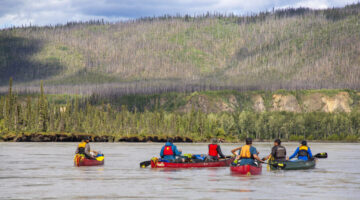
Water is a lifeblood of the Dawson Region. Rivers are how many people travel through the Dawson Region, for hunting, fishing and wilderness expeditions. The region’s streams are where the life’s journeys of salmon begin and end. Strong protections for rivers, water and salmon needs to be at the core of the Dawson Land Use Plan.
The plan is being prepared against the backdrop of a historically low return of chinook salmon up the Yukon River. Many factors may be contributing to the collapse of the run, but the Dawson Plan can play an important part in securing spawning and rearing habitat for salmon. Mining development can alter[1],[2] the natural flow of creeks and turn rivers brown with sediment. Salmon underpin cultural and ecological systems alike, and depend on healthy streams and rivers. By protecting the water that salmon depend on, the Dawson Land Use Plan can also safeguard the streams and rivers that tie the Dawson Region together.
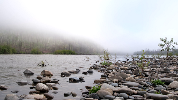
Our recommendation: Waterways are the region’s vital veins and deserve protection.
Our recommendation: The plan could better protect salmon by requiring mapping ahead of proposed development, so rearing and spawning areas are not lost, and by including indicators of salmon health, like water quality, so development doesn’t exceed what salmon can tolerate.
Advancing reconciliation through joint implementation
The Dawson Land Use Plan’s motto is “On the Land We Walk Together‘/ ‘Nän käk ndä tr’ädäl.” These words represent the importance of people coming together to create a strong future for the Dawson Region. One of the best ways to carry this spirit of partnership forward is for the Yukon government and Tr’ondëk Hwëch’in to jointly implement the plan. While the Peel Watershed Regional Plan includes clear language that it will be jointly implemented, this is not yet the case with the Recommended Plan. A few simple language tweaks will help ensure that the plan aligns with the intention of the modern treaties to advance reconciliation and renew the relationship between Indigenous peoples and the Crown to one of equal partnership.
Our recommendation: The plan should include clear language that it will be jointly implemented by the Government of Yukon and Tr’ondëk Hwëch’in.
How you can help
Public engagement on the Recommended Plan closed in December 2022. Check out the What We Heard report that summarizes public feedback, and stay tuned for updates!

