The ATAC Road to Rau would transform the Beaver River Watershed
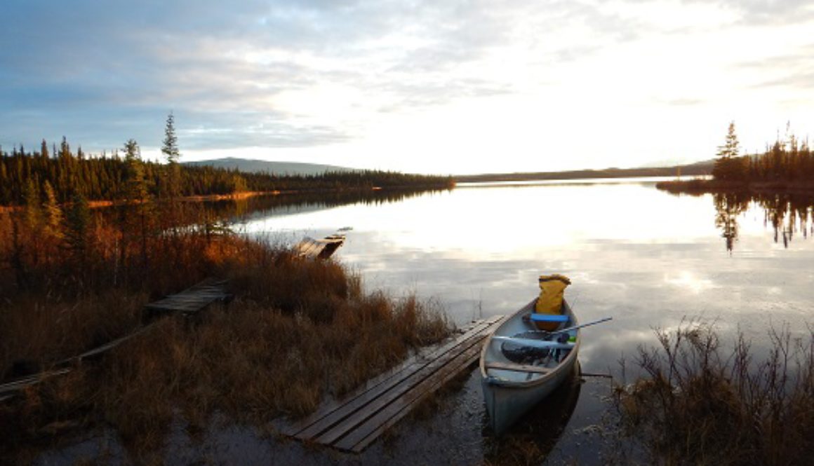
Header Image: Dusk on Hanson Lakes. The Hanson Lakes sit just west of the start point of the proposed road. Randi Newton
Written by: Randi Newton, Conservation Coordinator
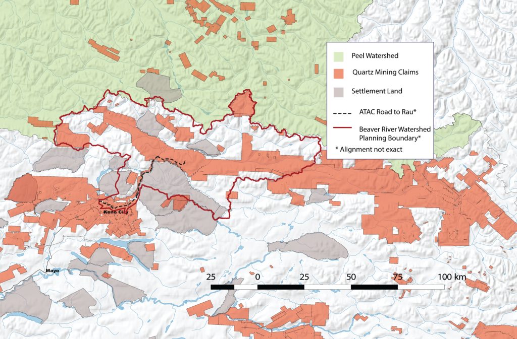
Almost two years ago, a recommendation from the Yukon Environmental and Socio-Economic Assessment Board (YESAB) cracked the door open for industry to transform the unspoiled wilderness of the Beaver River Watershed, a landscape perched at the Peel Watershed’s southern doorstep. In May 2017, YESAB recommended that Yukon Government give ATAC Resources, a mining exploration company, the go-ahead to build a 65 km mining road to access the Tiger Gold deposit on its Rau property. The region’s wild creatures, healthy landscapes, and clear waters are at risk.

Fortunately, the Beaver River Watershed Land Use Plan – now at the very beginning stages – is a chance to protect the wildlife, habitat, and intact ecosystems that give life to the watershed. We can still ensure that sustainability is at the heart of all decision-making. The Planning Committee is hosting a public meeting in Whitehorse on Wednesday, Feb. 6th (details below), and meetings have already taken place in Mayo and Keno. Show up to let the committee know that Yukoners care about protecting the watershed’s wildlife and wilderness.
Beaver River Watershed Land Use Plan public meeting
February 6th, 6 – 8 PM
Multi-Purpose Room, Kwanlin Dün Cultural Centre, 1171 First Avenue
Whitehorse
How did we get here and why is the plan so important?
YESAB’s decision to recommend approval of the 65 km Road to Rau stunned many Yukoners. The decision largely ignores the significant impacts on fish and wildlife identified by the Department of Environment and a contracted wildlife expert. Approving such a long road for a mining project still in the exploration phase was unprecedented. For context, the proposed road is only 8 km shorter than the drive from downtown Whitehorse to Carcross.
The proposed route cuts through habitat for moose, grizzly bears, salmon, and scores of other wildlife. The science of road ecology clearly shows these species will be harmed by things like habitat loss, road avoidance, and overhunting. If built, the road will cross 73 rivers and streams, including spawning and rearing grounds for salmon and Dolly Varden char. Only 8 crossings are bridged and, alarmingly, culverts or fords are proposed for the remaining 65. Sedimentation, habitat destruction and the obstruction of fish movement are big concerns.
Despite these concerns, we have a second chance to get things right and maintain a functioning wild landscape for the wildlife that depend on it. Before road construction can be authorized, Yukon Government and the First Nation of Na-Cho Nyäk Dun agreed that a land use plan for the Beaver River Watershed must be in place. This process is now at the very beginning stage. Getting the land use plan right is critically important because the future impacts of the road extend well beyond the road itself. Construction of the road could ultimately transform the entire watershed from unspoiled wilderness to a forever-scarred mining district.
Let me explain.
Right now, the Beaver River Watershed is largely undisturbed. However, Yukon’s mining recorder shows that the watershed is on the brink of change. A cascade of quartz claims stretch across the entire watershed and beyond, all the way to the border of the Northwest Territories. Quartz claims also extend north, and some are nestled along the Peel Watershed’s southern border. It’s only a matter of time before YESAB faces a torrent of applications to extend the road to these projects. Placer staking is sure to follow. Without a good land use plan in place to set common-sense limits on development and protect the region’s wildlife and wilderness, this single strand of road will lead to a tangled web of development.
What should the Beaver River Watershed Plan include?
While we don’t know much yet about the direction of the Beaver River Watershed land use plan, the future of the region’s wildlife and wilderness rest on a few key things:
- Using traditional knowledge, local knowledge, and conservation science to get a better baseline understanding of the region’s environment and wildlife. For example, right now there are almost no on-the-ground assessments of fish habitat at the proposed ATAC road water crossings.
- Understanding how the proposed 65 km road and future development will impact wildlife populations. For instance, studies show that grizzly bear survival decreases when roads are introduced. We can use modelling to predict how bears in the Beaver River Watershed will be impacted.
- Setting common-sense limits on development. Wildlife needs functioning habitat and we lose wildlife when we put too much development pressure on their habitat.
- Developing a robust system for wildlife monitoring and adaptive management. Decision makers need a way to understand what’s happening on the ground so they can make good decisions.
Only once all of these pieces are in place can we decide if the Road to Rau is right for the region.
How you can help
Come to the public meeting next Wednesday and stay involved throughout the process. The Planning Committee needs to know that you care about the watershed. CPAWS Yukon will stay tuned to the plan and let you know what’s happening.


