CPAWS Yukon
Posts by Adil Darvesh:
- Blog
- BlogArcticRefuge
- BlogBeaverRiver
- BlogDawsonRegion
- BlogMcIntytreCreek
- BlogPeelWatershed
- Campaigns
- Climate Change Campaigns
- Events
- Forest Campaigns
- FrontPageOurWorkSlider
- MDS
- News
- NewsArticles
- our stories
- Protecting our Wilderness
- Protecting our Wildlife
- Publications
- Uncategorized
- Wildlife Campaigns

Many species tolerate the existing roads in McIntyre Creek. Why is CPAWS Yukon opposing a new road?

Written by Malkolm Boothroyd, Campaigns Coordinator
Whitehorse’s Official Community Plan will help to determine the future of McIntyre Creek/Chasàn Chùa. Your input can shape this plan! Email your thoughts to ocp@whitehorse.ca or fill out the City’s survey.
Coyote pups tumbling about in a clearing. A calf moose trotting behind its mother’s towering legs. A pine marten standing up its hind legs and looking straight into the camera. These are a few of the thousands of images captured by the trail cameras we set up throughout McIntyre Creek last summer, and have been sharing on social media. But there was more to this project than documenting the adorable wildlife of McIntyre Creek.
We set out on our wildlife study because we wanted to understand how developments like roads and subdivisions impact the wildlife that depend on the creek. Last week the City of Whitehorse released its draft Official Community Plan—promising to work towards a park in McIntyre Creek—but also leaving the door open to a major road through the lower section of the creek. The Official Community Plan will help determine the future of McIntyre Creek, which means it’s a good time to take stock of our wildlife study.

We’re part way through analyzing our data. It surprised me, but in most cases roads didn’t have a statistically significant impact on wildlife distributions. One exception was moose, which avoided areas with lots of roads, while deer were more likely to be found in heavily roaded areas. Deer have a higher tolerance of people than other ungulates, and may favour places with higher human densities in part because their predators avoid these areas. Species like lynx, coyotes and snowshoe hares seemed largely unaffected by roads.
Our trail cameras only recorded a few grizzly bears and one single wolf, all in parts of McIntyre Creek with few roads. It’s possible that roads are negatively impacting these large predators, but our sample size was much too small to draw any statistical conclusions. These are preliminary results, and we haven’t finished analyzing all of the data we collected. These findings are definitely not what I expected, but they’re good news. It means that there’s still a lot of really good wildlife habitat throughout McIntyre Creek, and that most species can tolerate the existing amount of roads in the area.

There are lots of things this study doesn’t tell us. Our study can’t predict the impacts of building a new road through McIntyre Creek, or expanding the Alaska Highway and Mountainview Drive to accommodate more traffic. Building a third major road would be a big change for McIntyre Creek, and one that there’s no going back from. We’re fortunate to live in a city that is so rich in wildlife and wild spaces, but that could change if we take it for granted.
There are other reasons to be skeptical of a new road through McIntyre Creek. How will building a road from the roundabout on Mountainview Drive to the Alaska Highway near Kopper King alleviate traffic congestion? Anybody driving from Whistlebend into Whitehorse would be adding an extra kilometer onto their commute along with two left hand turns across busy roads, only to end up at the top of Two Mile Hill. There are values-based considerations too, like cutting a major road through an area full of walking and biking trails. And of course there’s the climate emergency. Building a new road strikes me as a 20th century solution to traffic problems— when the future of sustainable urban development depends on mass public transit and active transport.

The City will have to think about the road from a lot of angles—how wildlife use the creek, the connections that people hold to this place, and what the future of transportation looks like in Whitehorse. The results of our wildlife study may not lend themselves to making simple, decisive statements about the impacts of the proposed road on the wildlife of McIntyre Creek, but that’s fine. The prospect of a road through McIntyre Creek has always been a complicated question, and one that will reflect Whitehorse’s priorities as a City.
What’s your vision for the future of McIntyre Creek? A busy new road could change what we love about McIntyre Creek. We have a week to tell the City we don’t want it. Send an email to ocp@whitehorse.ca, or fill out the City’s survey by June 12th.
Corridor Conservation: My story as a youth inspired by McIntyre Creek
Written by Amelia Ford, McIntyre Creek Project Volunteer
As a grade 12 student at F.H. Collins Secondary School, I was given a project to complete within the final months of high school that explored a hobby, interest, or possible future career path. Essentially, the project could be anything under the sun, as long as it showed my focus and enthusiasm. Initially I was overwhelmed, as there was a huge variety of possible interests I could explore, but I ultimately settled with volunteering for an organization of my choice, CPAWS Yukon. Given my strong interest in the environment and conservation, working with such an organization was a pretty big deal. From December to March I joined Maegan Elliott, the lead behind the McIntyre Creek/Chasàn Chùa project, and helped both in the field and from my computer.
Originally, I was not very aware of the importance of McIntyre Creek or the significant threat it faces with our growing population. The City of Whitehorse has proposed developmental options to meet the needs of a growing city, including the expansion of Porter Creek, which would cut into the heart of the McIntyre Creek area. On top of that, the future expansion of the Alaska highway and increased traffic levels also pose a danger to wildlife in the area.
Though the expansion of development in these areas may be convenient in solving the problem of housing, the resources and home of many species living at McIntyre Creek would be in trouble. The Yukon is known for its vast lands and diversity of plants, animals, and ecosystems. McIntyre Creek subsequently plays an important role in connecting our wildlife to these different lands, which is what CPAWS and other organizations are trying to show through snow track surveys, collecting data, discussions, and advocacy.
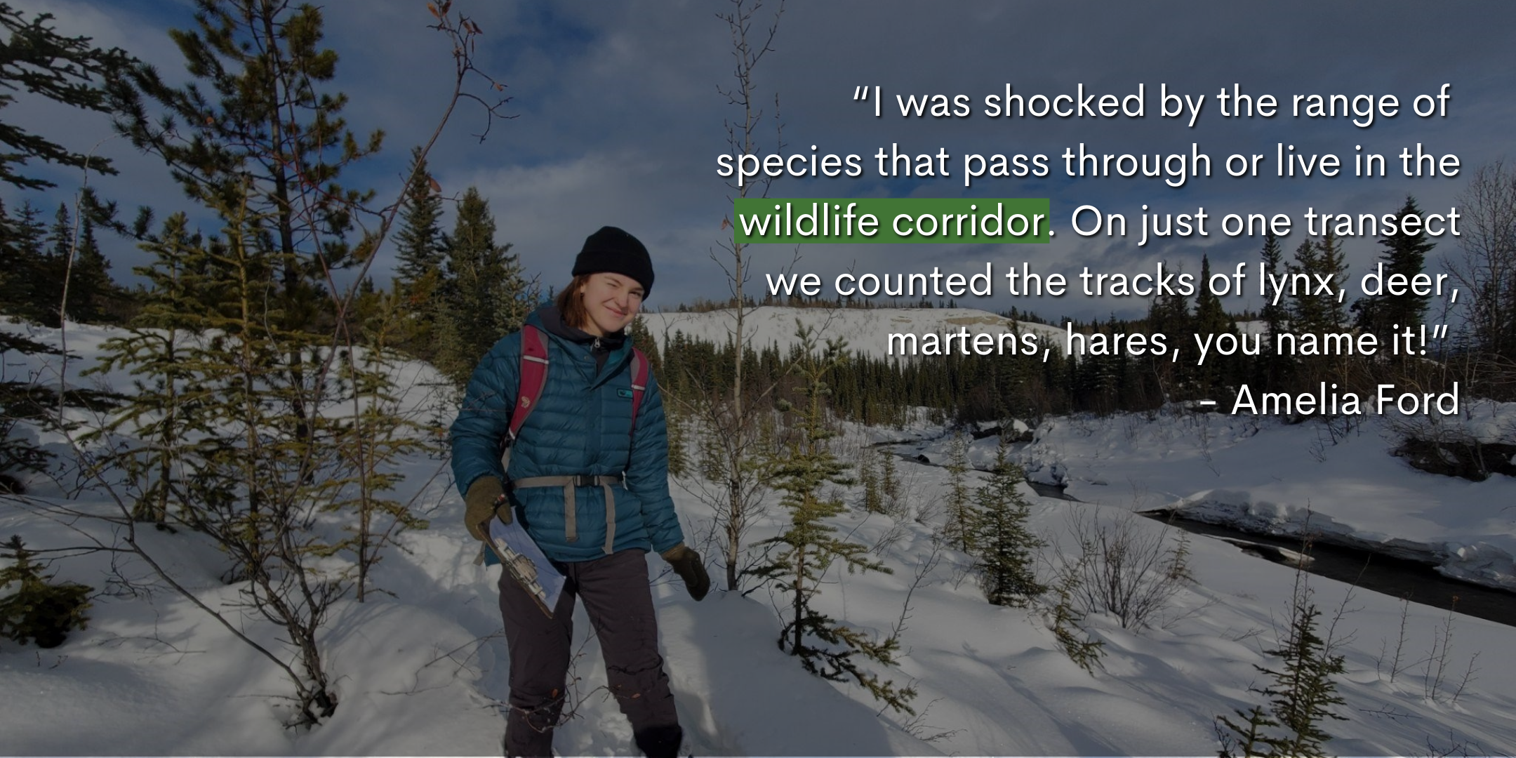
I completed a snow track survey in McIntyre Creek, and even within a small section of the area Maegan and I counted the tracks of many unique and different species. The survey involved traversing a 1.5 km long triangle, identifying and recording all of the tracks that cross the transect route, which in my case involved trudging through knee-deep snow and an unexpected spring crossing. I was shocked by the range of species that pass through or live in the wildlife corridor (it’s not just squirrels and the occasional bear). On just one transect we counted the tracks of lynx, deer, martens, hares, you name it! I further realized the variety of species when I entered data from multiple different surveys across McIntyre Creek into the main spreadsheet, which is full of a diverse range of animals. There’s evidently a large volume of wildlife that uses the corridor – however, it is also used by humans just as frequently.
This area plays a role in the mental well-being of our communities, especially during the onset of the COVID-19 pandemic. With a decrease in indoor gatherings, many took to the outdoors to find solace from the stress caused by the virus. Whether it be skiing, hiking, snowshoeing or walking, the McIntyre Creek area has visible evidence of use by our city’s population. And not just for recreational purposes – this area is also frequented by Yukon schools for educational purposes and for learning about our territory’s biodiversity.
From initially knowing next to nothing about this issue, I am super grateful to have been given the opportunity to work with CPAWS and learn about the significance of the land I use every day. Working on this project also showed me just how important actively making a difference can be. It’s easy to become overwhelmed with the constant onslaught of environmental threats our world faces, paired with the devastating impacts of our changing climate, but it is also important to remember the power and change we can create by advocating for these issues (especially as youth). For this reason, I encourage you to research and speak up about these types of issues, and to communicate with others and your community so we can conserve this land we are so fortunate to call our backyard.
Romance in the Wild
Written by Paula Gomez Villalba, Communications Assistant
Valentine’s Day is dedicated to celebrating love and affection. But what is love? We’re getting philosophical here at CPAWS Yukon because love can take on many forms. Especially in the wild. This Valentine’s Day, learn what romance looks like for wildlife in the Yukon and beyond.
For each species featured, you can swipe right on their photo to watch them in action.
Flying over 40,000km for love is the definition of commitment. Arctic terns migrate farther than any other animal, traveling the equivalent of three roundtrips to the moon in their lifetime. Their journey is a love letter not only to finding a partner, but also to the wild and productive ecosystems on their Arctic breeding grounds.
Terns are skilled fliers, so it’s no surprise much of their courtship takes place in the air. They form monogamous bonds through aerial chasing, screaming, and food offerings. These romantic flights can be pretty loud and chaotic when there’s hundreds of terns in a colony looking for love.
Together forever, black-billed magpies are also monogamous. Their romance begins in the fall or winter with males displaying their iridescent green tail and delivering food to a begging female.
Teamwork is super important. Magpies build their nests together and once there’s eggs, the female incubates while the male continues delivering food. Bonding for these birds is all about food, a love language arguably recognized across all lifeforms.
Lynx are typically solitary and territorial, but that all changes around Valentine’s Day. Mating season starts mid-February when males start following females day and night, sometimes even wailing for attention. But the romance doesn’t last. Male lynx ghost their partners once they give birth, leaving them to care for the young until next Valentine’s Day rolls around.
Red-necked phalaropes are endangered in the Yukon, which means finding a mate for these shorebirds is all the more difficult. And unlike most bird species, it’s the female who is in charge. Phalaropes have reversed sex roles, females are larger and compete with each other for males.
Male phalaropes often play hard to get and can be picky, but with good reason! They’re the ones that will incubate eggs and care for the young. Females have to defend a territory from other females and swim in circles around the male to convince him to mate with her.
For sandhill cranes, music is the key to love. Pairs form lifelong bonds through a mating dance where they flap their wings, bow, jump, and squawk in unison. Performing this duet each year strengthens existing relationships too. Sandhill cranes dance before migrating, so they’re ready to build a nest together by the time they reach their breeding grounds.
The heart of Wood Frog literally starts beating again when it’s time for spring and breeding. After hibernating underground, female wood frogs emerge filled with thousands of eggs. Males call to attract females and battle for a chance to fertilize a female’s eggs as she lays them. Romance for wood frogs can be explosive, with multiple males sometimes piling on top of one female.
Finding a lover can be dangerous, some might say deadly. While bald eagles will mate for life, getting there involves falling for your partner, or rather, with them. Bald eagle courtship involves a special ritual called a death spiral. They lock talons while high in the air and fall, cartwheeling to the ground, separating just before reaching it. Thrill-seeking bald eagles aren’t afraid of domesticity though, pairs will also bond by using the same nest each year and adding to it each breeding season.
Did you learn something new? Share the love with a friend, partner, or family member.
Want to help fight for love and the species we featured? Consider making a donation to CPAWS Yukon. We work to conserve wild spaces in the Yukon that wildlife rely on to survive and breed.
We’re Moving!
Written by: Chris Rider, Executive Director
We have some big news: next month CPAWS Yukon will be moving to a new home! This relocation is the culmination of several years of work from our team, and we believe it is the right move to set us up for ongoing success. But of course, we’re feeling a lot of mixed emotions about it.
We’re excited to be moving into a modern space that will meet the needs of our growing team, but we’re also sad to be leaving a building that we feel profoundly connected to. There is so much history for our organization at 506 Steele St., and we know that many of you will share the emotions that we’re feeling at this time.
That’s why I wanted to take a moment to walk through why we made this decision, and what we can look forward to once we are in our new office.
Why did we decide to move?
The house we are in has a lot of character, and holds a lot of sentimental value for all of us. Unfortunately, it is an older building and while beautiful, it is also energy inefficient and difficult to keep warm.
It was built as a house, not an office, which means that space is not used as efficiently as it could be. This wasn’t a big issue when four or five people worked here, but as the team has grown, the challenges have become more apparent. We’ve been able to make it work up until now by sharing office spaces, and having staff work in open workspaces or other nooks and crannies, but it’s not ideal. Since the pandemic, this has only become more of an issue.
Knowing these challenges, in 2019 we hired an architecture firm to assess the property, to help us consider the best options for the future of the organization. They looked at several ideas, one of which was an overhaul of 506 Steele St., to make it meet the needs of CPAWS Yukon for years to come. We learned that raising money for this kind of work is extremely challenging, and that there are many uncertainties when it comes to renovating a building like ours. These issues made the idea of the renovation project feel far too precarious for a non-profit like ours.
We also briefly considered working with a developer to convert the lot into a brand new commercial/residential property, but it was too big a risk, with huge amounts of uncertainty for us. We want to focus on protecting nature, not construction.
Ultimately, it became clear that purchasing a newer space in an existing building was the best path forward.
Where are you moving to?
Our new office will be at 101-301 Hawkins St., right across the road from our friends at the Yukon Conservation Society (we’re calling it conservation corner). We will be taking over the ground floor commercial space that was built by Kobayashi + Zedda in 2008.
It is a little smaller than the current building, but it’s modern and well insulated, and the space can be used much more efficiently to provide proper offices for our team of 9 people.
The office was previously home to the Kwanlin Dun First Nation lands department, and before that an engineering firm. Over the coming weeks, we will be working with a contractor to complete the modifications that will give it the look and feel of CPAWS Yukon, and then we hope to move in before the end of January 2022.
One of our priorities is to make sure it’s a great space for events, and we are really looking forward to welcoming people to join us there whenever it is safe!
What is happening to 506 Steele St.?
We will be selling our current building, and it is due to hit the real estate market on December 6th. We hope that the buyer will choose to keep the building as it currently stands, and that they will give it the love it deserves.
Can you afford this?
We are able to afford this because of the foresight of Juri Pepree and the rest of the staff who were involved in the purchase of our current building. Over the years it has appreciated in value, making it possible for us to raise the majority of the funds we need to complete this move when we sell it. We will also use some money from our reserve fund and we are taking on a very manageable mortgage, which will be paid off over the next twenty years.
Is there anything else?
Yes, one thing. We know there are many, many memories from the years that CPAWS Yukon has been in this office. Most are wonderful, some are from times of challenge. If the COVID-19 outbeak makes it possible, we hope to be able to welcome people to connect with it one last time in January, before we move.
In the meantime, if you have a memory you’d like to share, please add it to the comments here, or on facebook. It’s important to us that we keep these stories alive!
Thank you and we’ll see you at our new office soon!
How do we give a voice to the wilderness?
Written by Chris Rider, Executive Director
Have you ever wondered how we choose the issues we speak out about, or why we frame things a certain way? Maybe at one point or another, you’ve thought we didn’t speak out strongly enough about something important?
Every day our team makes decisions about what goes into our public messaging and in this post, I want to give you a peak behind the curtain, to show you how our team goes about transforming words and ideas into meaningful change.
One of our biggest areas of work at the moment is our campaign to protect the critical ecological and cultural values in the Dawson Region so I’ll use this as a case study. Let’s break down how a campaign like this works.
Image: Roads and quarries on a hilltop near Dawson City, by Malkolm Boothroyd
The first thing we always need to do is decide what we’re working towards. In every case, when we work on a specific area or region, we look to the goals of the First Nations whose land it includes, and we use that to inform our own goals. This is key.
For decades, governments and conservation organizations identified land that they deemed worthy of conservation, and then created parks without ever working with the First Nations, Métis and Inuit whose land they were “protecting.” This is not how we work. We believe that our work to protect wild spaces must be done in a holistic way that includes wildlife, people, and ways of life – it’s critical that everything we do includes a commitment to honouring First Nations values and rights.
This means conversations with First Nations leadership including Chief and Council, as well as government staff. We also do what we can to ensure we are hearing from as many citizens as possible, especially unofficial leaders in the community such as Elders and youth.
In the case of the Dawson land use plan, Tr’ondëk Hwëch’in undertook a thorough process to determine the most important values in the region, and this gave us an excellent baseline for our own goals.
We also look at the science and draw on our own experience to make sure we are being rigorous and reasonable in everything we ask for. Partners like the Wildlife Conservation Society Canada, Ducks Unlimited Canada and the Yukon Conservation Society help with this a lot.
We make sure that what we are advocating for is right, asking ourselves some difficult questions along the way. These include:
- Are our goals grounded in western science and traditional knowledge?
- Are our goals aligned with those of the First Nations on whose lands we are working?
- Have we found the right level of ambition? Too much makes us seem unreasonable and easy to disregard, while too little ensures that we fall short of achieving what’s needed.
- What are the most important priorities that we cannot bend on? And;
- Are there some areas where we think a compromise could work?
Once we know what it is that we want to achieve, we start to think about how we can achieve it. This “how” can change over time, while the “what” generally stays consistent. The next question usually is, who do we have to convince?
At this stage of the Dawson land use planning process, there are six people sitting on the planning commission, plus supporting staff, who will be taking everything they have heard and creating the Recommended Plan.
Image: Randi Newton, our Conservation Manager presenting to the planning commission, by Chris Rider
We needed to show them that the changes we are recommending are important, based on accurate information, and supported by the broader community. We have to do this in a way that resonates for them as people, as Dawson residents and, in many cases, as Tr’ondëk Hwëch’in citizens.
Dawson City is a small community, where placer miners, environmentalists and Tr’ondëk Hwëch’in citizens all live together. In some cases, one person can be all three at once. It’s a community where these roles – and the values associated with them – have created conflict and tension, as anyone who has lived in the Yukon long enough is sure to have seen.
That’s why there has long been a fear that land use planning could tear the community apart. We heard this from everyone involved in the process, and it is something we know the commission has been incredibly concerned about. It is something we have remained conscious of throughout.
Image: Placer mining in the Indian River, by Malkolm Boothroyd
These considerations all feed into our public messaging. There are times when we have been angry or frustrated at things we disagree with, and we have felt the need to speak out. When we do, we are careful to conduct ourselves respectfully and balance what we are saying with the outcomes we hope to achieve. I am the first to acknowledge that sometimes we may err on the side of caution a little bit too much, but it’s because we know the damage that can be caused with just a few misspoken words.
When you watch one of our videos, read our materials or see us in the media, you’ll see we focus on talking about our vision. We speak about the importance of the land, the wildlife and the connections that people have. We speak about the cultural connections that Tr’ondëk Hwëch’in and other First Nations have maintained for millenia. And whenever we talk about mining, we talk about the impacts that it has on the land and the need to ensure that important values are protected. We are careful not to demonize the industry or the people working in it, because that doesn’t align with our own values, and we also know that it wouldn’t be productive.
Anger can be satisfying and effective, but only when it’s directed wisely and at the right people. It’s an emotion that’s best used sparingly, if you want people to take it seriously. Of course, we know there are times when it’s important to be angry and when those times arise, we will not hesitate to hold people to account.
All of these thoughts help drive our campaigns and I hope this post gives you a small insight into how the CPAWS Yukon team works to protect nature in the Yukon. Moreover, I hope that when you look at our materials or hear us in the media, you will see this reflected in everything you see.
And we won’t always get it right. An example of this came last year when the vice-chair of the Dawson planning commission resigned to protest the fact that Yukon Government hadn’t implemented a moratorium on staking anywhere in the region. His position was one that we supported, but we were trying to balance a number of priorities at that moment and hesitated to speak up for just a second. By the time we were ready to act, the momentum was already lost and we had missed an opportunity to draw attention to something very important. Thankfully a moratorium that covered around 40% of the region was ultimately announced, but we had learned an important lesson along the way.
I encourage our supporters to continue reaching out if you ever feel like we’ve taken a misstep. We will not always ultimately agree, but I promise you that we consider everything you send our way. And if you found this helpful or interesting, let me know – we might even make this a series of posts, breaking down different aspects of our work.
In the meantime, thank you for your support! We couldn’t do it without you.
Want to stay in the loop?
Sign up for our e-newsletter to stay up to date on all our work!
Calculating the future of the Indian River
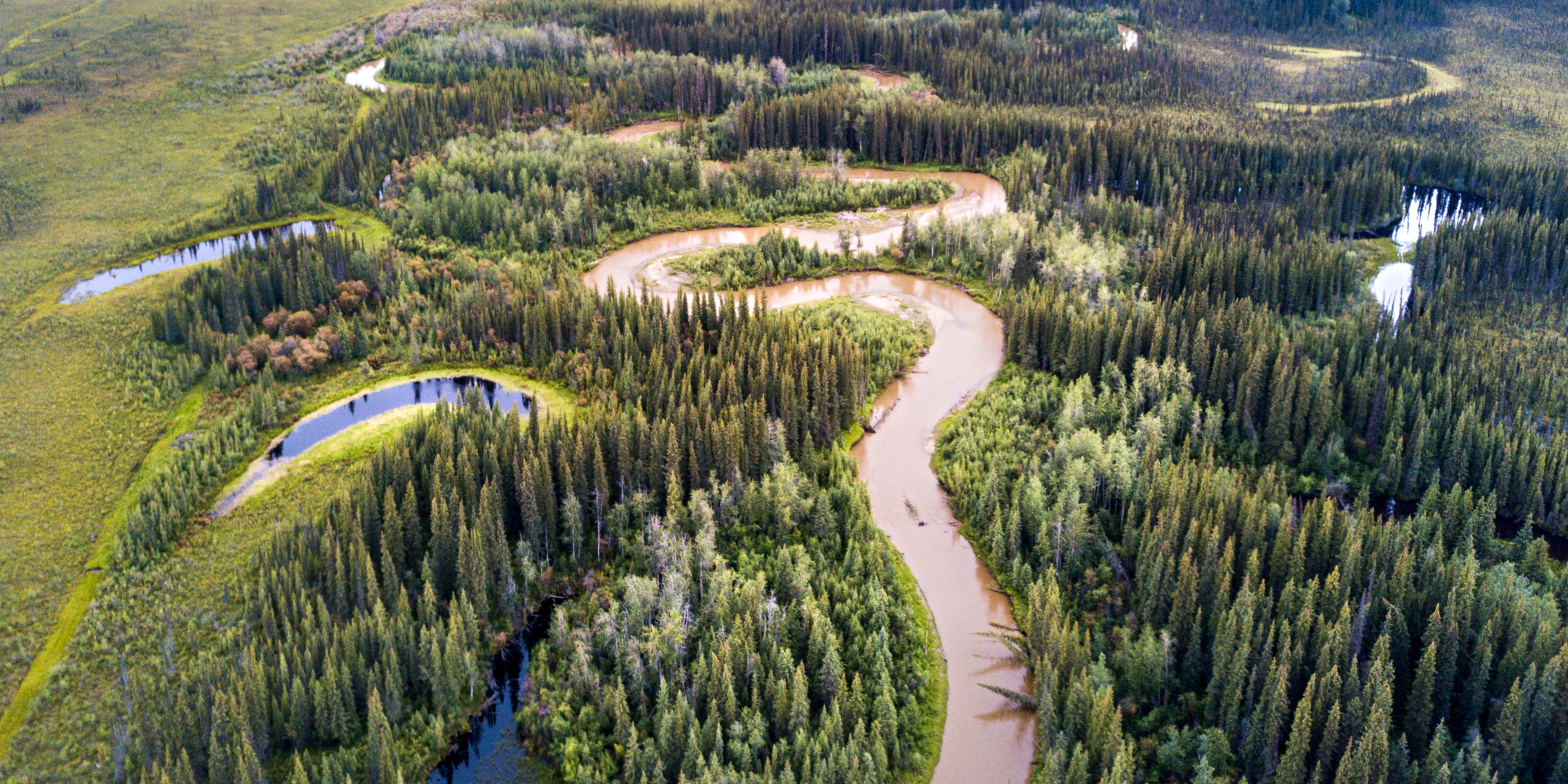
Header Image: Indian River near Sulphur Creek, by Malkolm Boothroyd
Written by Malkolm Boothroyd, Campaigns Coordinator
What does the future of the Indian River look like?
That question was at the front of my mind as I read the draft land use plan for the Dawson Region. One number jumped out—5%. That’s the amount of disturbance the land use plan would permit in the landscape management unit that encompasses the Indian River, and the rest of the goldfields. 5% may not sound like much disturbance, but when you look closely it’s shocking.
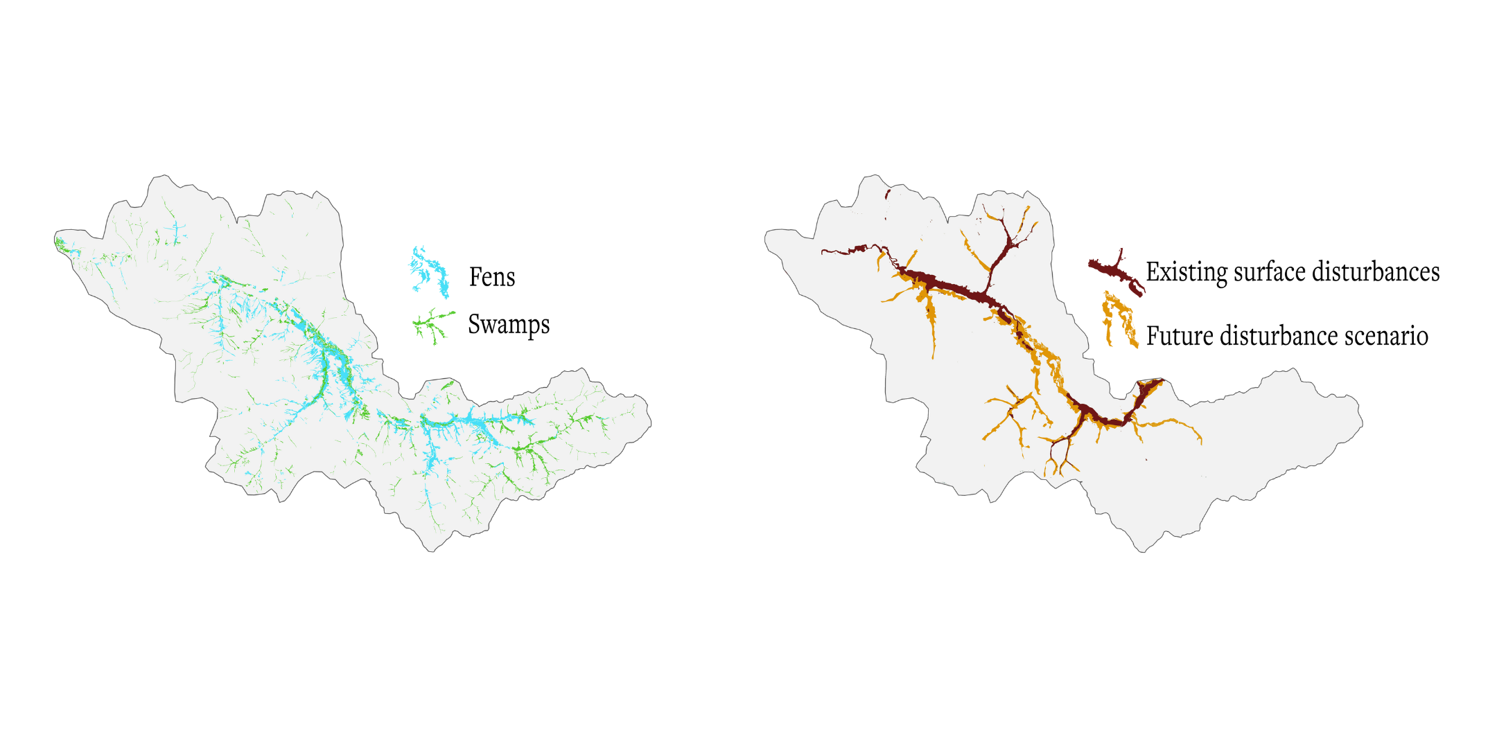
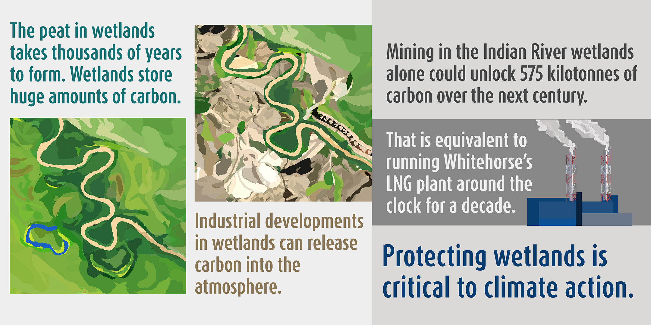
I explored some of the implications of this number in this story map. I decided to go into more depth in this blog because a) it’s a topic that fascinates me, and b) it’s good practice to be transparent about the math and the assumptions that go into making conclusions like the ones I made in this story map.
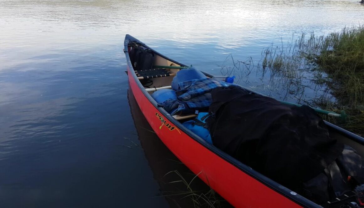
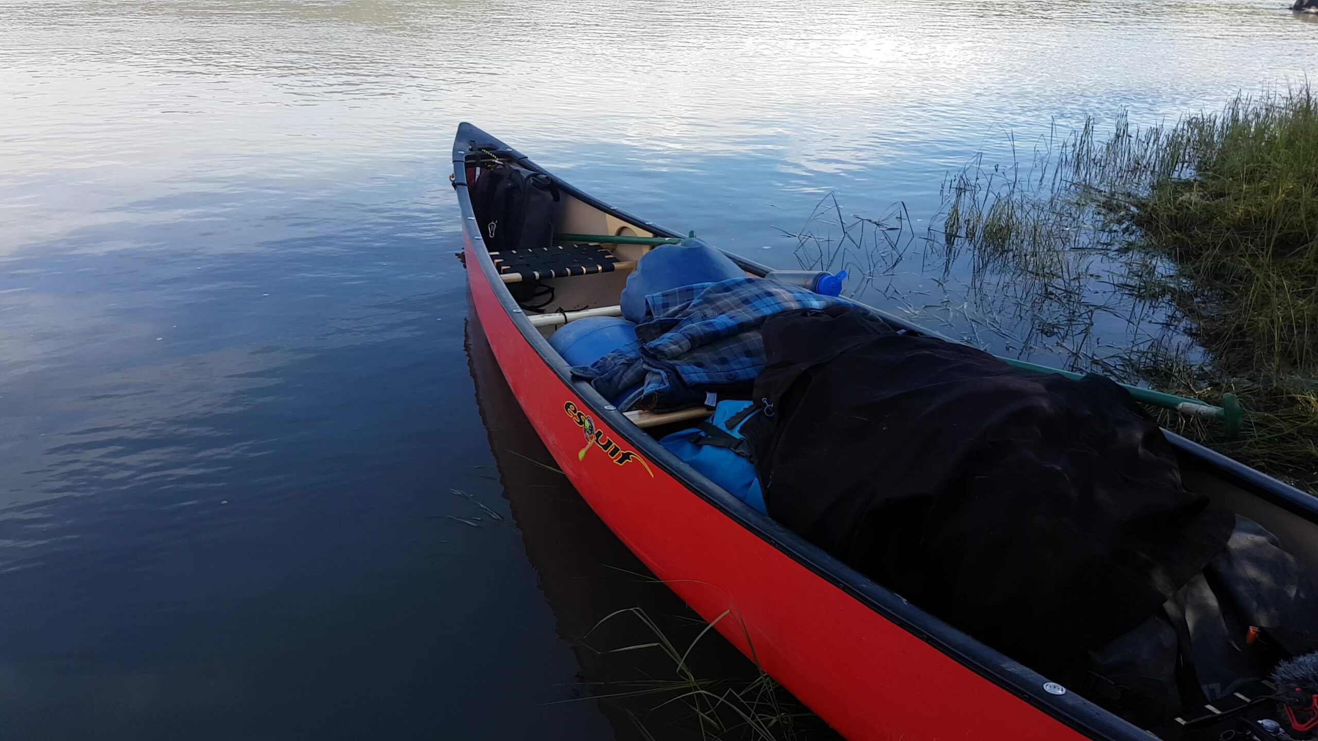
I’ve been drawn to the Indian River ever since I canoed it last summer. It’s a river that few people ever paddle, and it’s clear why. In places the river is so coiled that you have to paddle three kilometres of river to make it six hundred metres as the raven flies. Some parts are choked with fallen trees, and we lost count of the number of portages we made. Sections of the river are engulfed by placer mining, and the noise of machinery drowns out the sound of the river. Still, there are places where the river carries you far away from the mines. Then you’re surrounded by ancient trees, and you drift by river banks that are crisscrossed in moose tracks.
The Indian River wetlands have long been a breadbasket to the Trʼondëk Hwëchʼin, but many citizens have expressed that they no longer feel comfortable hunting and fishing in these areas. Sorting out the future of conservation and development in the Indian River was one of the big challenges facing the Dawson Land Use Planning Commission, and it’s one part of the plan that needs some big improvements.
Okay, time for some math.
The first question I wanted to answer was how much new development the land use plan would permit. The Indian River is part of Landscape Management Unit (LMU) 12 – East – Nächo dëk. This is designated as an Integrated Stewardship Area IV, the designation that permits the greatest possible amount of development. Surface disturbances (such as areas covered by mines, gravel pits, work camps, roads and farmland) are allowed to cover 5% of the landscape. Linear disturbances (like roads, trails and cut lines) can cover 5 kilometers per km2. LMU 12 is 6,606 km2 in total, so that means there could be up to 330.3 km2 of surface disturbances, and 33,030 kilometers of linear disturbances.
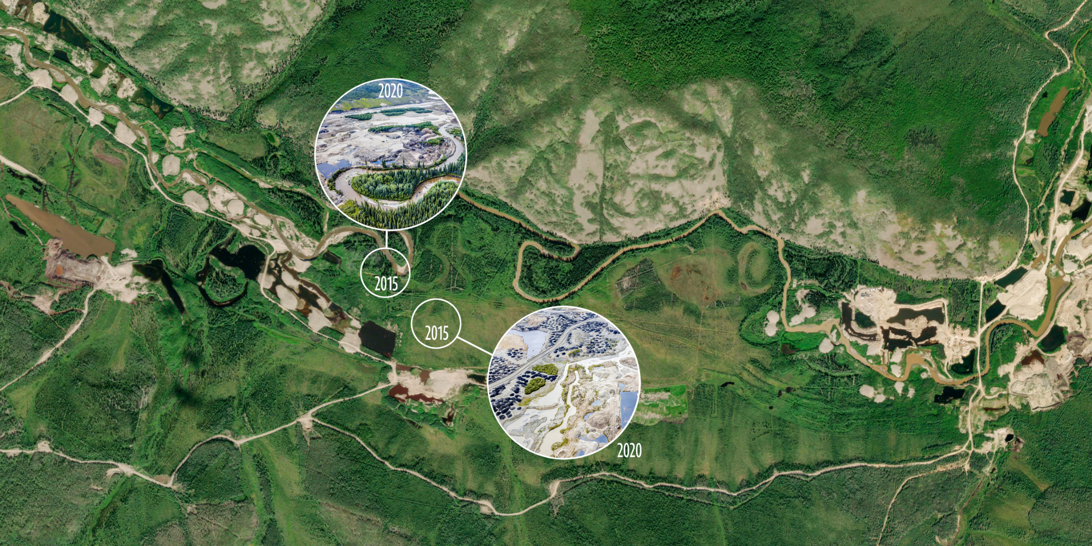
I started by looking at the existing disturbance maps for LMU 12. These maps are around ten years old (new maps are expected next spring), but they’re still helpful. The disturbance maps show there are already 113 km2 of surface disturbances and 3,552 kilometers of linear disturbances.
For the purposes of my analysis for the story map I created one single disturbance polygon by combining the surface and linear disturbance layers. I transformed the linear features into polygons by applying a 10 metre buffer around roads, and a 5 metre buffer around all other features. These numbers are a rough estimate, though I measured the width of the Hunker Creek Road using Google Earth, and it seems like the right ballpark. This new disturbance layer was 152 km2 in size.
There’s one big catch in the land use plan’s 5% disturbance limit. It’s calculated by averaging out disturbances across the entire landscape management unit, but in reality disturbances are not uniformly distributed. Almost all the development within this area is associated with placer mining, which closely traces the bottoms of valleys—which also happen to be some of the most fragile and biodiverse environments within the landscape. The way the land use plan is written, a whole lot of development could be packed into valley bottoms, while still keeping within the 5% limit.
I was curious to know exactly how much development occurs within the bottoms of valleys. For the purposes of this analysis I defined a ‘valley’ as an area within 500 metres of a river, or 250 metres from a stream. I excluded areas higher than 700 metres. These valleys make up 1,656 km2. That’s 25% of LMU 12, but 76% of disturbances fell within these valleys. Put another way: my combined disturbance polygon averaged out to 2.3% disturbance across all LMU 12, but reached 7% disturbance within valley bottoms.
Next, I extrapolated this to a scenario where disturbances consume 5% of LMU 12. If new developments follow the same patterns as prior disturbances, then disturbance levels within valley bottoms could reach 14.8%.
This is already a tremendous amount of disturbance within valley ecosystems, but it doesn’t give the full picture. This assumes that development would be spread evenly throughout the valleys of LMU 12, but in reality disturbances are concentrated within the Indian River watershed. I wanted a picture of what development around the Indian River could look like.
To do this, I first worked out how much new development could be added to LMU 12. If there’s currently 152 km2 of disturbances at last count, then there’s room for an additional 178 km2 of disturbances within the 5% disturbance limit. Some of this would be accounted for by the footprints of linear disturbances, so I applied the ratio of surface: linear disturbances (113:39) within my combined disturbance polygon and estimated from 178 km2 of disturbances, 131 km2 could be new mining disturbances. That would bring the total mining-related disturbances within LMU 12 to 245 km2, plus 85 km2 of roads, trails, cut lines and so forth.
Finally, I used QGIS to create a 245 km2 large polygon layer. I did this by expanding existing disturbances, and creating new disturbances in QGIS from lands staked for placer mining. Finally, I removed rivers and “undisturbed” wetlands from the land available for disturbance. The land use plan states that there shouldn’t be new mining in undisturbed wetlands, but what an “undisturbed” wetland is, isn’t clearly defined. For the purposes of this map, I decided to define “undisturbed” wetlands as wetland areas 100 metres or more from existing disturbances. In reality this will be a much more complicated process, which I’ll leave up to hydrologists and land use planners.
So here are the maps.
It’s important to note that these maps are just a scenario, and there’s no guarantee that these specific places would be mined. Rather, these maps show that the draft plan would allow for tremendous amounts of new development—and these disturbance limits aren’t very limiting.
There’s already been a lot of mining along the Indian River, but that doesn’t mean we should write the valley off as a wasteland. There’s a lot that’s worth conserving. I hope the Dawson Land Use Planning Commission will make some big changes to the land use plan so that the Indian River gets the protection it deserves.
Op-Ed: Yukon at a crossroads with Fortymile caribou herd
Written by Malkolm Boothroyd | Oct 5, 2021
Photo by Malkolm Boothroyd.
Current land use planning for the herd’s range offers an opportunity to keep the volatile population on the right path.
Read the full editorial as published in The Narwhal on October 5th, 2021.
—
Op-Ed: Yukon at a crossroads with Fortymile caribou herd
About twenty caribou have blocked the road. I pull over to the shoulder and park. It’s a hot July day on the Top of the World Highway, about 90 kilometres northwest of Dawson City, Yukon. A light haze hangs in the air, smoke from wildfires burning across the border in Alaska.
It’s the Fortymile caribou herd. Some caribou are lying on the gravel, others stand as three-week-old calves nuzzle around their legs. Velvet still coats the antlers of the bulls. Several hundred more caribou are scattered across the mountainsides ahead, and a few dozen are bedded among the stunted alders that furnish the rocky outcrops above the highway.
It’s been slow going all afternoon. I’d only just gotten back on the road after waiting three hours for a hundred caribou to clear the highway a few kilometres back. I open the truck door and step out, trying to make as little noise as possible. I tiptoe around the back of the truck to where my companions, Chase Everitt and Chris Clarke, have parked. Chase is a fish and wildlife technician and a Trʼondëk Hwëchʼin citizen. Chris works with the First Nation’s Land Stewardship Project.
The next moment I’m distracted by the roar of wheels churning through gravel. I look up in time to see a white SUV rounding a corner towards us. The vehicle speeds by without slowing down, quickly closing the gap to the caribou. Chris hammers the horn of her truck, and finally the SUV shudders to a halt and reverses back towards us. “There are laws about not harassing wildlife,” Chase tells the driver, a clean shaven guy with greying hair and Alberta plates. “You need to wait until the caribou move off the road.”
“Are you serious?” the man snaps.
He starts venting about public health measures adopted to control the coronavirus pandemic and then circles back to the caribou. He suggests he should be allowed to do what he wants.
“I’m sick of people telling me what I can’t do in my own country.”
There are stories from a hundred years ago when Fortymile caribou were so numerous that it took days for the herd to cross the Yukon River. The paddlewheelers that plied the river between Whitehorse and Dawson would have to moor up and wait for the caribou to finish crossing. The herd has been through staggering crashes and spikes in the intervening time, from numbering in the hundreds of thousands, to just a few thousand in the 1970s. Concerted efforts to recover the population began in the 1990s. Wildlife authorities in Alaska began an expansive program of predator suppression, while Yukon hunters and the Trʼondëk Hwëchʼin stopped harvesting the herd. By 2017, the herd had rebounded to more than 80,000 caribou.
There’s something poetic about the Fortymile herd recovering to a point where it can once again stop traffic, but our Albertan friend doesn’t seem amused. He pulls a U-turn and speeds back towards Dawson, waving his middle finger at us as he disappears.
The Fortymile caribou are one of those animals that everything else seems to revolve around. Bears and wolves follow in the wake of the herd, and the footsteps of countless generations of caribou are etched into the mountainsides. Fortymile caribou sustained the Trʼondëk Hwëchʼin, and caribou meat helped to feed the tens of thousands of prospectors who flocked north during the Klondike Gold Rush. This excessive hunting by newcomers drove the herd to crisis, and displaced the First Nation’s harvest. The Fortymile caribou may have faded away for a time, but its recovery is bringing new optimism, as well as new fears.
I’d come here hoping to get photos and videos of caribou to use in the advocacy work I do with the Yukon chapter of the Canadian Parks and Wilderness Society. The Yukon is in the middle of land use planning for the Dawson region, which will determine which parts of the herd’s range will be protected, and how much development can happen in the rest. This is a critical time for the Fortymile caribou. Some biologists worry that food shortages within the herd’s range could trigger another population crash. Meanwhile, new mining developments could encroach upon the herd’s remaining range. The next few years will shape the future of the herd for decades to come.
The memory of the Fortymile caribou still lingers on the landscapes they once inhabited. Ancient caribou trails line mountains in the Dawson Range, even though the herd has not been seen in these lands for more than 60 years. The herd once ranged throughout the central Yukon and Alaska, some winters migrating almost as far south as Whitehorse. One traveller described canoeing down the White River in 1909, where “for forty miles we were running through one continuous mass of caribou. The narrow valley and high bald mountains on either side, swarmed with the animals.” In the 1920s, the herd probably numbered around 250,000, according to Alaska’s Department of Fish and Game.
Profligate hunting of the Fortymile caribou began at the turn of the 20th century and accelerated through the 1930s as new roads opened the highlands to hunters. Historical accounts from game officers in Alaska described people firing into herds — leaving some caribou crippled, and others dead with their meat left to waste. In a single season, 10,000 caribou were killed by hunters in one game district in Alaska. One warden wrote that “most people are content to believe that the animals are in countless numbers that cannot be exhausted.” By the 1930s, the herd was in serious decline. Wolves and wildfires likely worsened the herd’s freefall, and by 1940 fewer than 20,000 remained. The herd had recovered somewhat by 1960, only to plummet again. By 1975, there were only around 5,000 left, according to the Yukon government. The once expansive range of the Fortymile caribou contracted to its very core, in the hills between Dawson City and Fairbanks.
Thanks to decades of recovery work, there are more than 10 times as many caribou in the Fortymile herd as there were in the 1970s. Still, there hasn’t been a corresponding increase in the herd’s range. It’s hard to say why. The networks of mines that extend south from Dawson City might deter caribou from crossing these habitats, but there are other explanations too. Trees and shrubs are flourishing at ever higher elevations as climate change heats up the north. That means the alpine migration corridors, those places above treeline that once unlocked the central Yukon, may now be too overgrown for caribou to use. It’s also possible that the Fortymile herd has lost its collective memory of its old range and the pathways leading there. Migrations have to be learned, and this knowledge could have died out decades and decades ago with the last of the caribou that ventured into central Yukon.
The herd’s failure to reestablish its old range means that caribou are packed tightly within its core range. Some biologists suspect that the herd has surpassed the carrying capacity of the ecosystems it inhabits — essentially that there aren’t enough grasses, sedges and lichens to sustain 80,000 caribou. Insufficient food makes it less likely for cows to give birth, and more difficult for the calves that are born to survive. There are fears another population crash could be looming. This has led wildlife managers in Alaska to push for more hunting to bring the herd’s population down. The Yukon government and the Trʼondëk Hwëchʼin First Nation recently agreed on a new management plan, which includes a small hunt for non-First Nations hunters. It’s a new era for the Fortymile caribou.
The hills surrounding Dawson City trend steadily higher as you go west towards Alaska, and slowly the hilltops begin to shrug off the cloak of the boreal forest. These tundra ridges are the heart of the herd’s summer habitat. In the windswept highlands there’s relief from mosquitoes, and lichens and grasses to feed on. Fortymile caribou give birth to their calves across the border in Alaska, then in late June and early July huge congregations of caribou move into the Yukon, following the ridgelines to skirt the tangles of spruce and alder that fill the valleys.
Many of these ridges are also lined with mining roads, winding away towards placer mines in the valleys and hardrock exploration properties in the alpine. Over a quarter of the herd’s core range is blanketed by quartz mining claims. Study after study — from Alaska and the Yukon, to Alberta and the Northwest Territories — warn of the impacts to caribou from industrial development. Developments like roads, mines and oil and gas infrastructure displace caribou from ecosystems, interrupt migrations, and make it easier for predators like wolves to prey on caribou.
Big decisions are looming about which parts of the Fortymile caribou herd’s range will be conserved, and which areas will stay open to mining. In the Yukon, decisions like these are made through the territory’s land use planning process, born from the Umbrella Final Agreement between Yukon First Nations and the Crown. In June the Dawson Land Use Planning Commission released the first draft of its plan. The plan divides the Dawson region into 23 different landscape management units, each with its own land use designation. Forty-five per cent of the region has some form of conservation designation, and the rest is open to varying levels of development.
The plan recommends strong protections for the very core of the herd’s range within the Matson Uplands, a mountain range along the Alaska border, west of Dawson City. But the remainder of the herd’s key range is at risk. Most of the herd’s remaining critical summer range falls within the ‘Fortymile Caribou Corridor’ landscape management unit. This area is divided by elevation, with high elevations open to limited development and low elevations open to moderate development. In alpine habitats, the industrial footprint cannot exceed one quarter of one percent of the landscape. This threshold is relatively low, but it’s calculated by averaging disturbances across the 800 square kilometres of alpine within the unit. High amounts of disturbance could still occur within small areas. Any mining development within ridgetop habitats could interrupt caribou migration corridors, or displace them from key summer habitats.
With a few modifications, the Dawson Land Use Plan could provide strong protections for the Fortymile caribou. It’s critical to keep alpine ridges free from new industrial development, and the plan should designate these habitats as conservation areas. The plan should also ensure there’s ample wintering habitat for Fortymile caribou. Caribou disperse across lower elevations in the winter, and developments within core wintering habitats should remain within levels caribou can tolerate.
The word restore comes up a lot in conversations about the Fortymile caribou herd. There’s restoring the herd to a robust population, and the herd restoring parts of its old range, but it’s equally important to restore people’s connections to the herd.
A few Trʼondëk Hwëchʼin citizens began hunting the herd again in the 2000s, but rebuilding relationships with the herd has been slow. There were generations of Trʼondëk Hwëchʼin who barely hunted the herd. Young people like Chase Everitt are changing that. “I just like seeing animals,” he says. “Even after the shot, it’s not the excitement of ‘I got one’ it’s ‘I get to see it more, see what it actually looks like, everything about it.’ ”
Chase describes his first time hunting the Fortymile caribou. He shot one caribou from a group of four, then the sound of the rifle echoing off the hills set the landscape into motion. Thousands of caribou stirred across the mountains ahead of him. The image sounds a lot like accounts I’d read from a century ago, when people spoke of mountainsides so thick with caribou that the landscape itself seemed alive.
Chris and Chase head back for Dawson. I drive another kilometre up the road, then pack a bag with camera gear and start bushwhacking. I head for the top of a hill, not far from where I’d seen caribou congregating earlier in the day. After a few minutes I break free from a tangle of alders into the clear. Soon a hundred caribou appear just ahead along the ridge. I duck down among a clump of spruce and wait. The caribou burst into a canter and jostle towards me. The herd passes within 30 metres of me. The air is heavy with the sounds of grunting and clicking tendons. Then they’re gone.
A Summer Spent at CPAWS
Written by Preet Dhillon, Conservation Intern
The COVID 19 pandemic proved a challenging year for many universities, as classes shifted from an in-person learning experience to online classes offered remotely. I found myself, along with other students, in a unique and new situation. Instead of attending classes and engaging with teachers and peers on campus, ‘campus’ became the desk in my room while classes were held on the screen of my computer. Come the month of May the remote school year had come to an end; it was time to go back home to the Yukon. After a year of learning online I was looking forward to spending a summer at CPAWS Yukon.
As I reflect on what I have gotten up to in these past few months, I am grateful for the opportunity to have had the position of conservation intern over the summer. Here you will find out how I spent my summer at CPAWS and what I was able to do.
I started out my summer helping Conservation Coordinator, Maegan Elliott, with fieldwork aimed to monitor the biodiversity of McIntyre Creek. I was able to learn about the methods used to capture the biodiversity such as motion trapping cameras, bat detectors and Autonomic Recording Units (ARUs). While setting up these systems we explored a variety of different areas such as soggy wetlands, tall pine and spruce tree forests, aspen groves and more! McIntyre Creek is an incredible area, filled with a variety of plant life and wildlife.
I enjoyed hiking through the McIntyre Creek area and exploring the diversity it has to offer, while learning of how the different methods work, how to set them up and the value that they hold in assessing biodiversity.
I enjoyed exploring McIntyre Creek throughout the summer, and I would encourage many others to do the same. I discovered McIntyre Creek to be a very diverse area, filled a with a variety of plant life, wildlife, and different natural landscapes. I was able to collaborate with the Yukon Conservation Society’s summer intern, as we worked on a booklet called “A Walk-Through McIntyre Creek”. This booklet features directions for a 2km hiking trail and information about the First Nations, natural history, plants, wildlife of McIntyre Creek and more!
Furthermore, with an interest on Yukon bumblebees, I was also able to monitor bumblebee diversity in McIntyre Creek. Blue vane traps were placed at a variety of sites in the McIntyre Creek area, for a few weeks. Each bumblebee was then identified by local biologist Syd Cannings. At one of the sites, I was able to encounter the Western Bumblebee listed as a special concern on species at risk. This allowed me to discover the importance species at risk have on larger scale.
Additionally, after a year away from the farmers market due to the pandemic, we were excited to make a reappearance as we greeted familiar faces and introduced ourselves to some new ones. I was able to spend each Thursday at the market along with other members of the CPAWS team, where we would provide information and updates to the public on CPAWS work. I enjoyed interacting and engaging people on their interests surrounding Yukon wilderness and the CPAWS organization. Despite the windy days that proved challenging when trying to keep displays put together, the farmers market was a delightful experience and would like to thank everyone that dropped by!
I find summers to take a very long time to arrive as we wait for them through the cold months. Interestingly, summers seem to end way sooner than you expect. I find my summer spent at CPAWS, to be similar. Although it was short and sweet, I am fortunate to walk away plenty of knowledge and am thankful for the CPAWS family who made it so great and helped me so much.